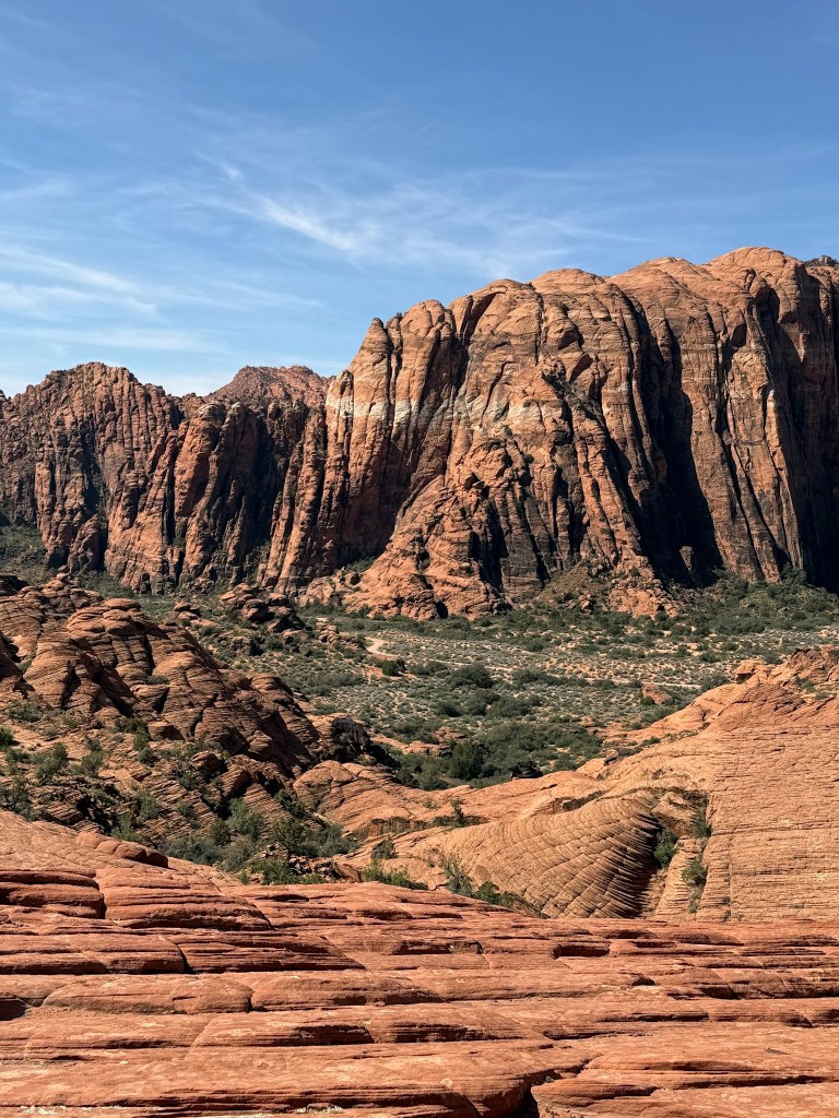
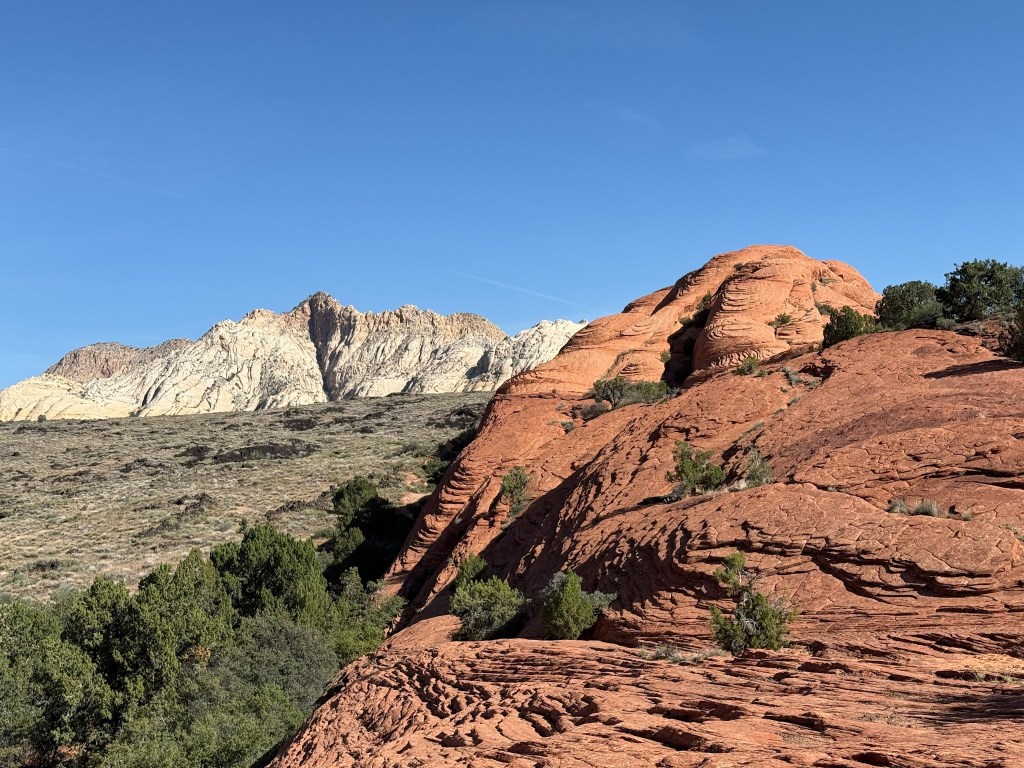
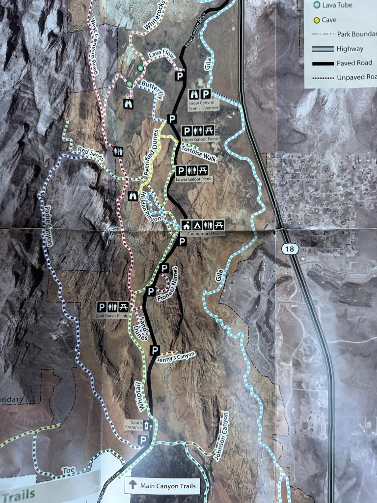
Snow Canyon State Park, St. George Area
The reds of the sandstone in so many textures and cypress green mixed with a bit of the distant white mountains are incredibly beautiful.
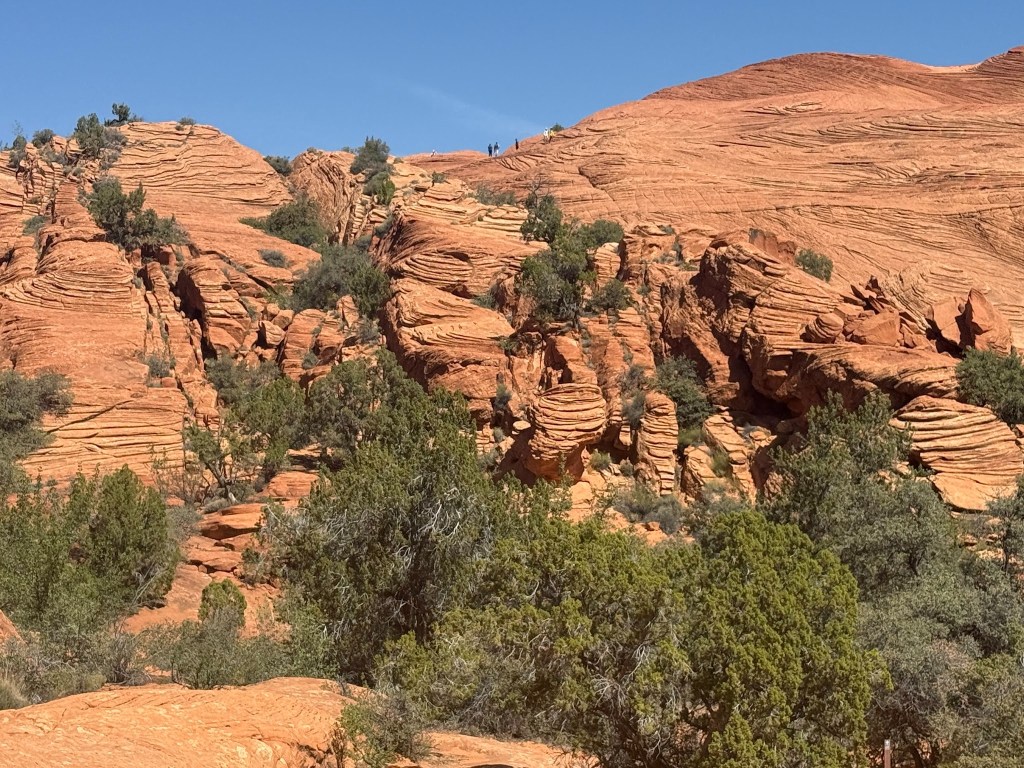
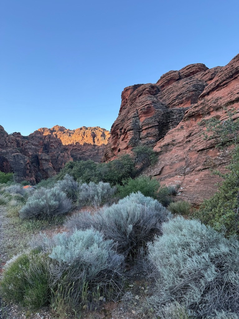
Petrified Dunes /Lava Flow Hike
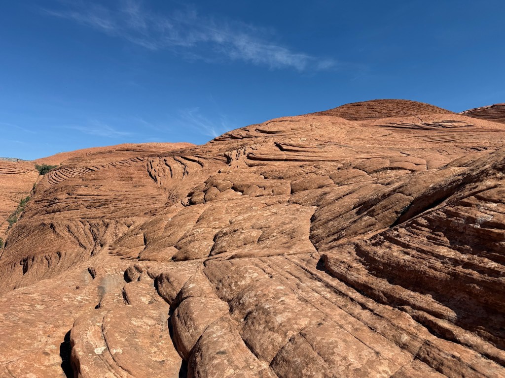
Luckily they were petrified and not sandy dunes – made the hiking a whole lot easier and oh so beautiful. All in all, a new type of hiking for us as we did the loop.
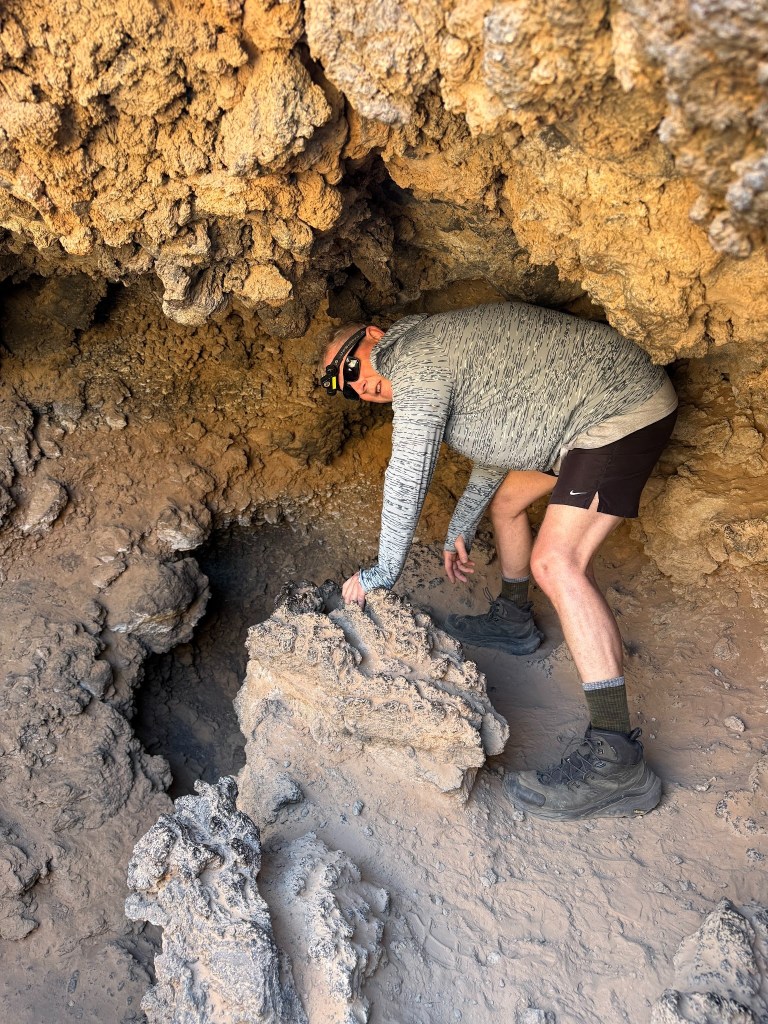
It started with the Whiptail bike ride (great paved 6 miles) – uphill battle but then one could contemplate the glorious ride down when we returned in the heat of the afternoon. Then the Red Sands Trail to the Butterfly Trail (not sure why the namesake of this one) to the Lava Flow Trial. Here we started down a lava tube, but it was a bit too ominous for us to go and explore.
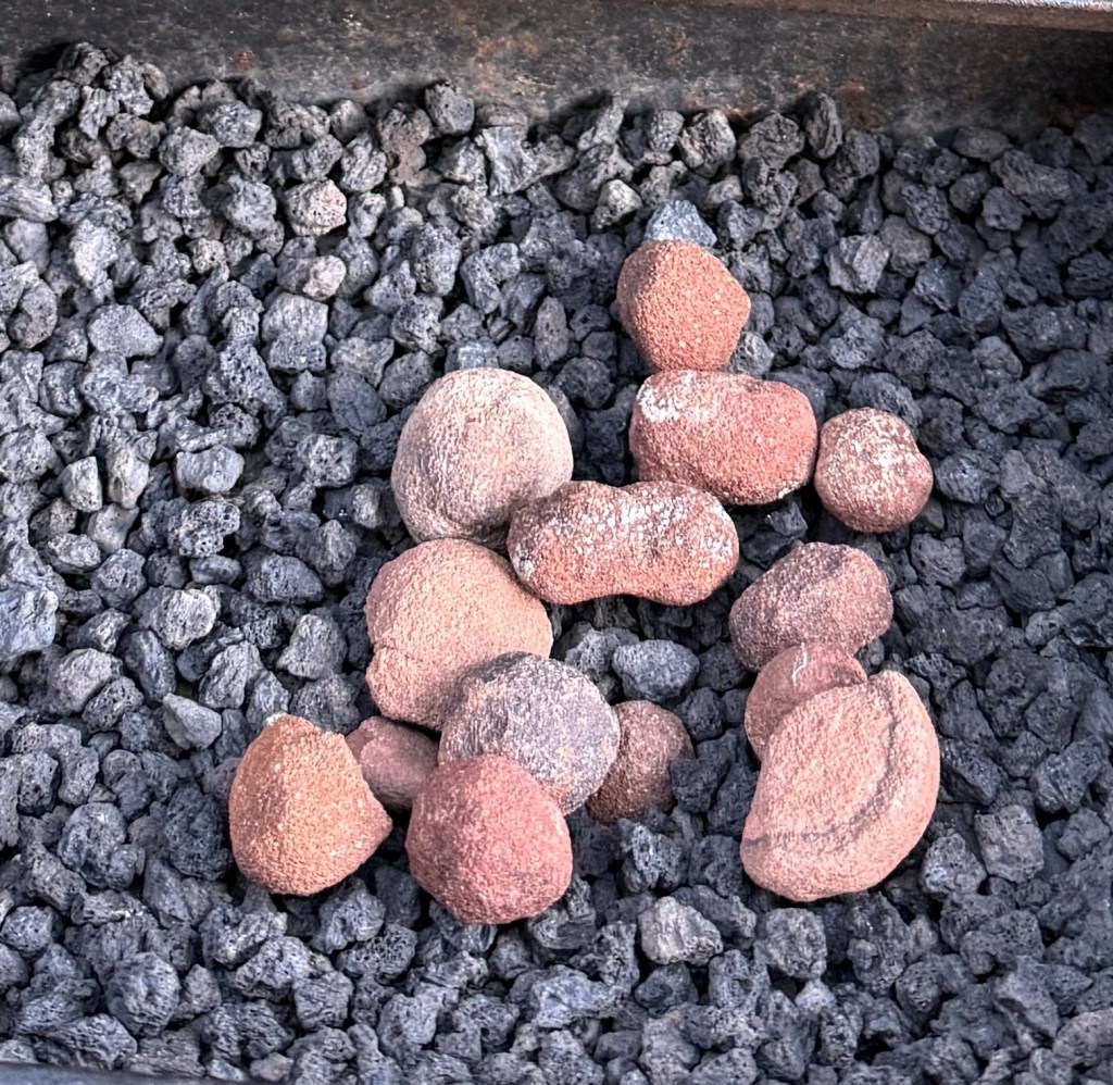
The ones in Volcanoes National Park in Hawaii were much easier to access instead of ducking through and climbing down the ah-ah. We learned there is another lava byproduct in the area – they are Moki Marbles which are a high iron oxide content sandstoned cement that erodes into round balls.
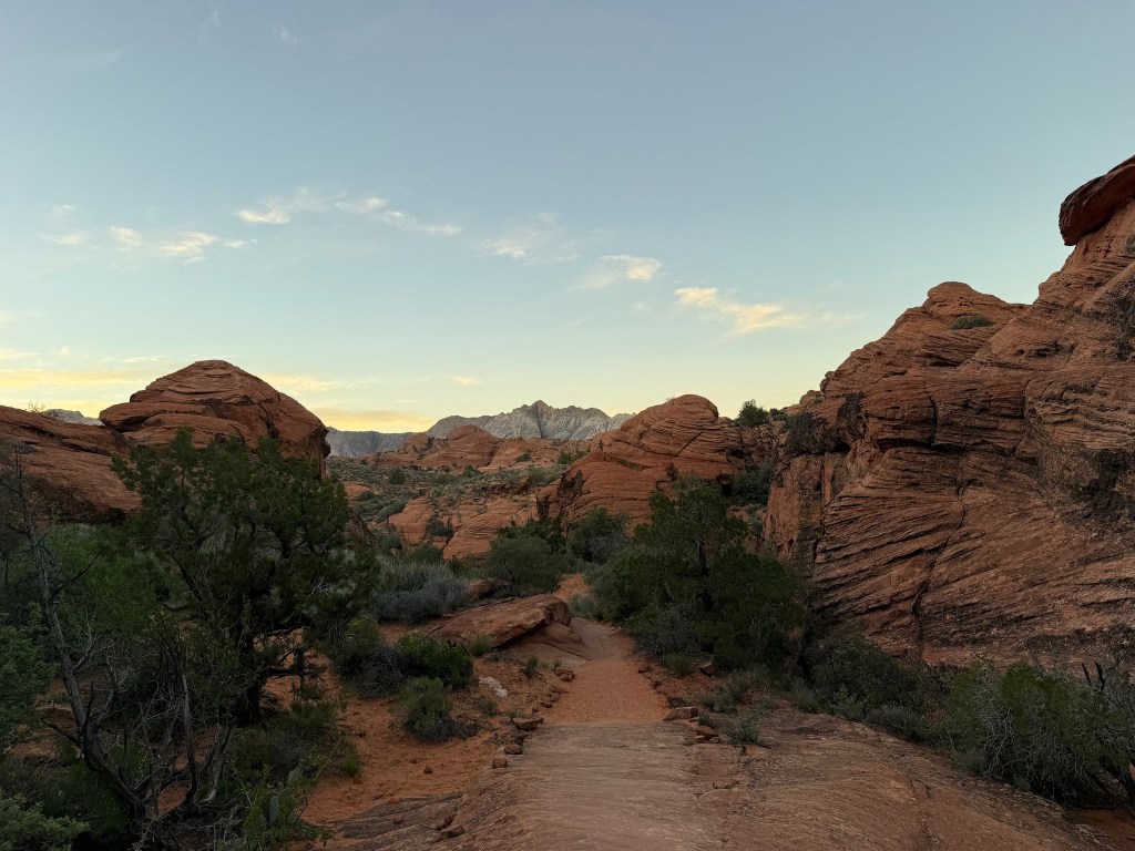
It would have been nice and cool in the lava tube as the temperature for this time of year was unseasonably high. It was really hot to walk across the mountains of Petrified Dunes with the majestic white mountains and the green cypress trees trying to root wherever they could.
It was hot but found spots in the shade of a tree to rest and water down. Knowing that where we parked our bike was a nice downhill all the way to the campground, kept us going.
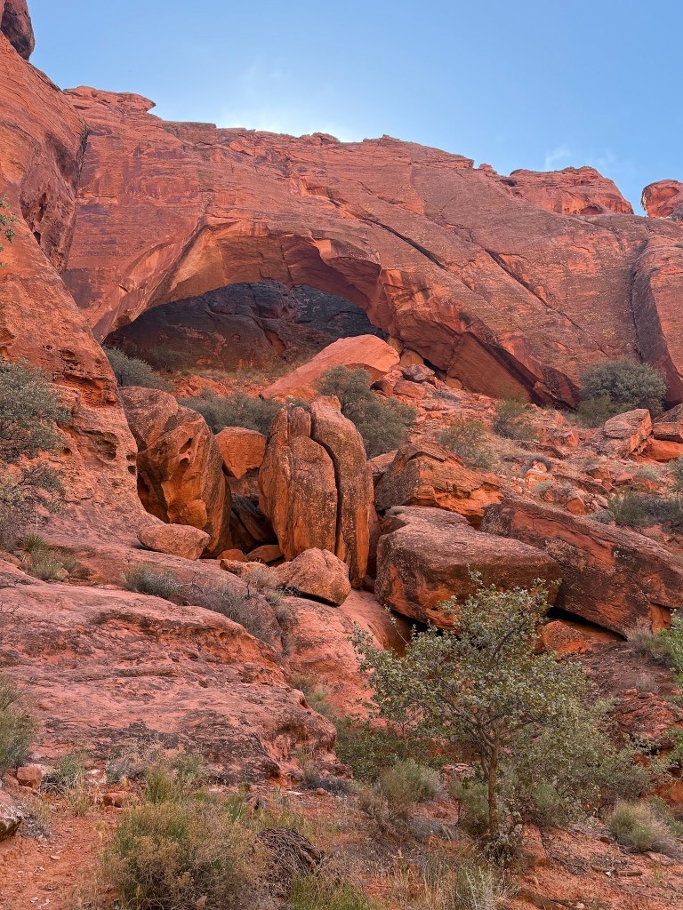
Jenny Canyon
This was the first slot canyon that I had experience during my April 2022 visit and needed to show John since after all we named our middle daughter Jenny.
Access was from the Snow Canyon Drive, and one could bike ride down the Whiptail, but it required a bit of a ride up the Snow Canyon Drive which was 25mph speed limits and speed bumps – not too dangerous with basically no shoulder – not a single car passed us just a couple of bicyclists who sped by and they weren’t even E-bikes and vroom, they left us in the dust on the slight uphill.
On the way up we discovered we could ride up the road – more like push our bikes up the road and access the Whiptail Trail through the Sand Dunes Parking Area. We had not realized this on the way down to Jenny. There are very few bike cross overs between the Snow Canyon Drive, the Whiptail and the West Trail.
West Trail is an 8 mile mostly gravel multi-use trail with small inclines. This made for a nice evening ride because the hills were shaded starting at about 5 pm as the sun disappeared behind them and temperatures cooled.
Hiking the short Pinon Trail was perfect for our first evening after the 7 hour drive to get here. The trailhead is conveniently located across from the campground and makes a nice 1 mile loop with a bit of up and downs and wedging between boulders and the views were incredible.
Johnson Canyon was a guided tour that was supposed to teach us about wildflowers, but there weren’t many, so it turned into a bird lecture. Since that canyon was only open to the tour at this time, there were lots of cool prints to be seen since feet had not passed that way and a really neat bridge.
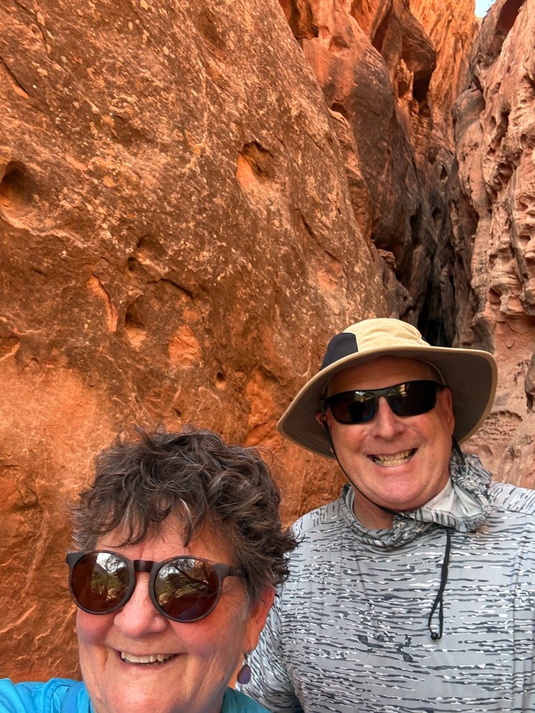
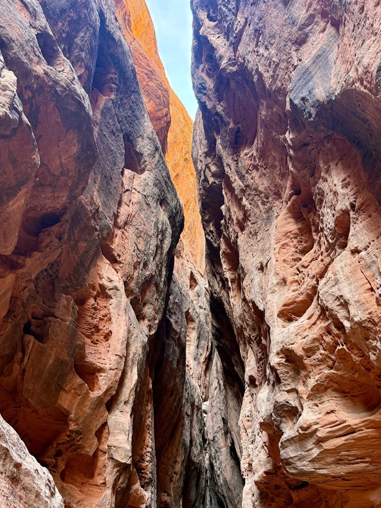
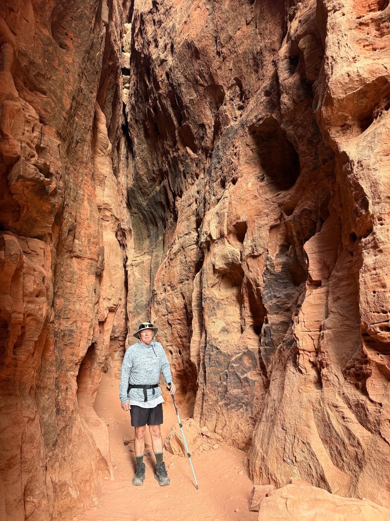
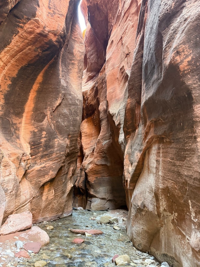
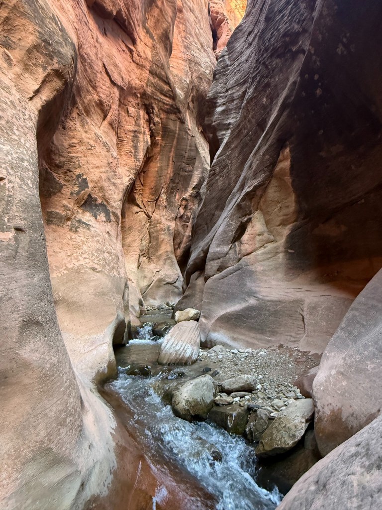
Kanarran Falls and Slot Canyon
We completed the Bucket List item in Day 4 and saw this amazing slot canyon in our rented neoprene boots. Also, our first ever private tour guide was experienced, and it was so worth it !

Benji did a perfect job of providing a helping hand where needed and slowing where needed for uncertainty or photos or to chat and show us some Moki Marbles. He really is a well travelled 28 year old, switching jobs, careers as an geology major, outdoor enthusiast and educator for kids. He said we were very easy people to guide because he is used to 12 year-olds, we’ll take that as a compliment. He said that in comparison the Narrows Hike in Zion is a lot longer and has deeper spots.
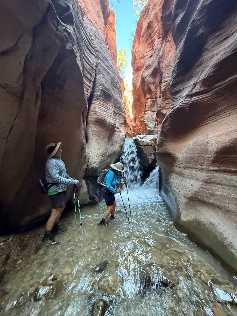
We probably travelled through the creek less 1/2 mile with the first 1 ½ miles being trail hiking. The last ¼ mile or so were in the narrow slots of the Canyon. They call the hike the Kanarran Falls Hike and nothing about the slot canyon to keep it on the down low. I think this is because the falls were nothing super special for us at least.
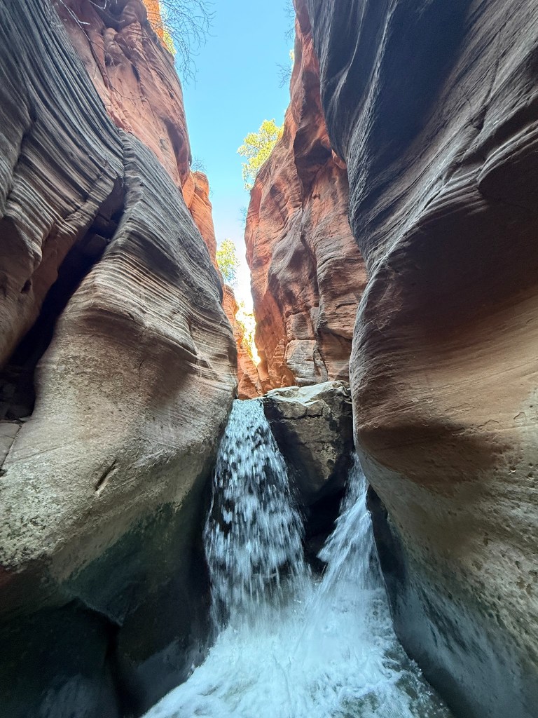
The slot canyon was the wowza for us. There were very few people and I got some great photos!
We had decided to go to the local pizza joint for dinner – the on draft Polagamy Porter was very bland.. Benji had told us some BLM land for boondocking that night, but it was always a bit difficult to locate the spot in the dark. After a U turn, find the Verlitan Scenic Overlook Sign and spot up the gravel road which, like most BLM dispersed roads, has plenty of potholes and rocks around which to maneuver in the darkness. We would return to the River Rock Roasting Company for breakfast which sat high above a canyon looking down on a creek and had plenty of outside seating. The boondocking site had plenty of good signal and our handy dandy T Mobile Hotspot got my photos onto the cloud within about 20 minutes.
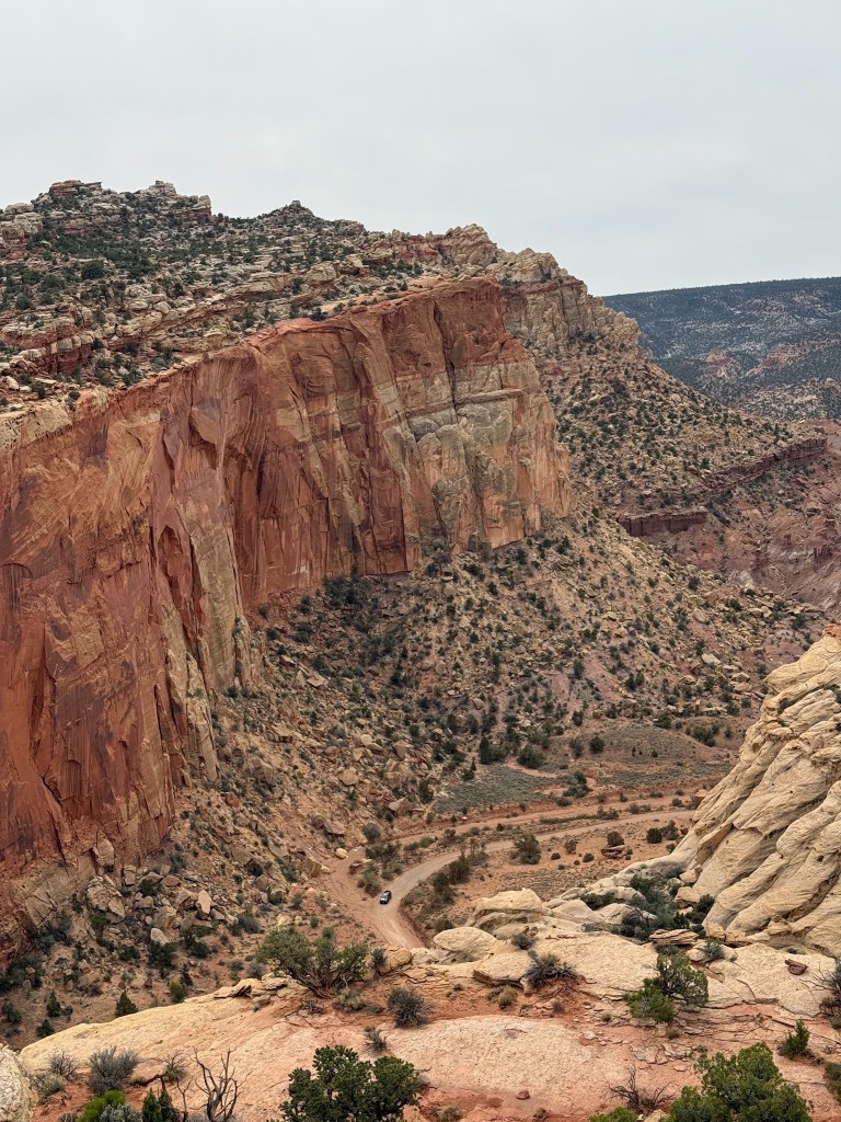
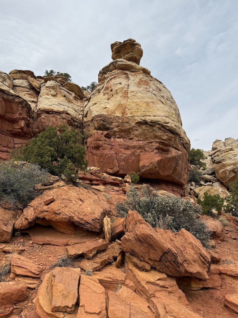
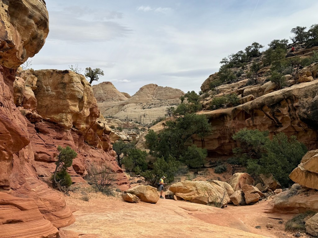
Capitol Reef National Park
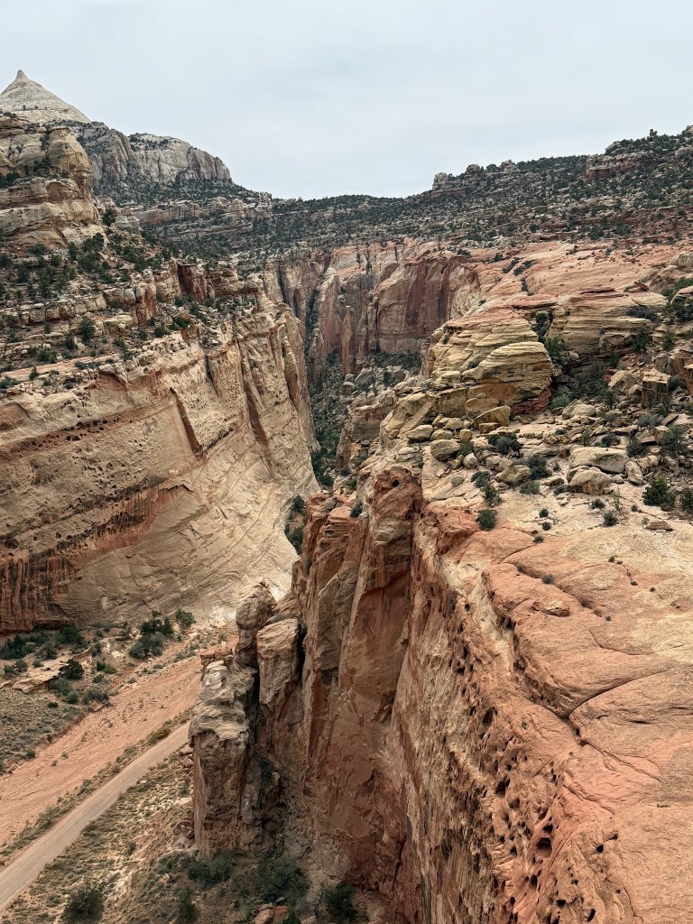
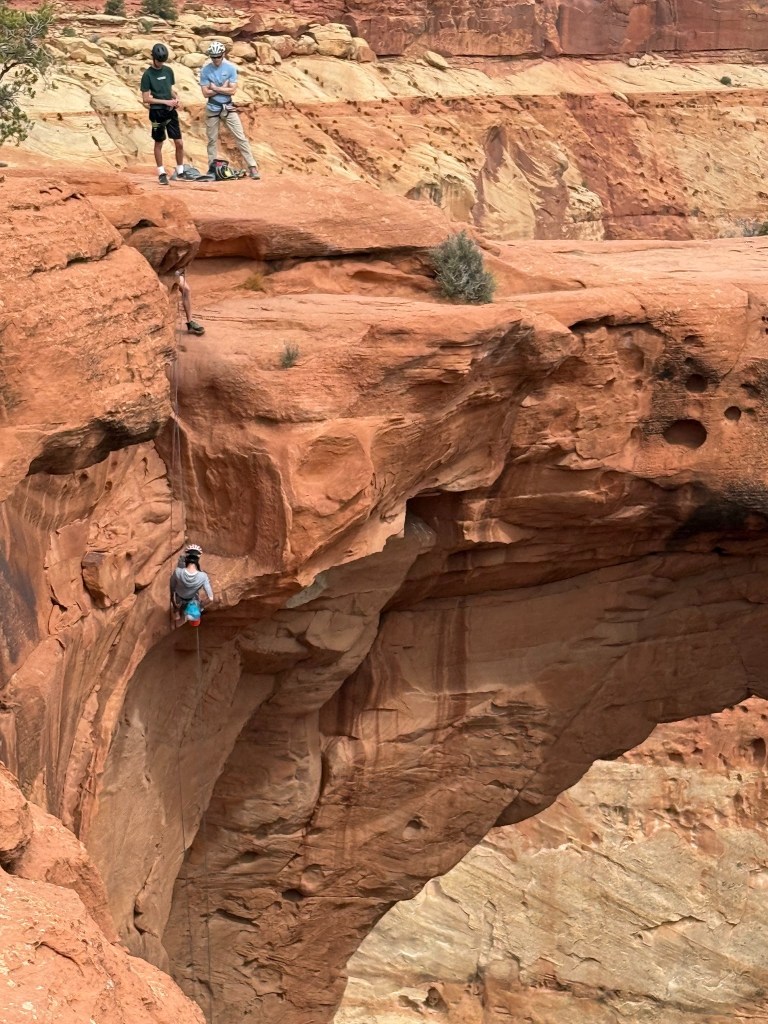
Cassidy Arch – named after Butch Cassidy whose boyhood home we also passed was on our top ten hikes of all time. Probably Top 5, but haven’t really constructed that list yet – so who knows. From Vinny’s Parking Spot to understand the hugeness of it all. There is a parking lot access after driving down the Grand Wash which is a dirt road that was very well maintained and turns into a trail. If you wanted a longer hike 10 miles, you could hike from the Fruita Campground on the Cohab Trail.
The NFS said there is no evidence of Butch Cassidy and his gang hiding out in these parts, but it helps with popularity of the folklore since he was raised nearby. The Robinhood gang of Butch’s who would hold up stage coaches and trains and supposedly give money to the poor. Looking down the gorge was incredible. Hiking the trail had amazing boulders and towering vertical cliffs.
So many large cracks in the rock cliffs that you wouldn’t want to be around in one of those flash floods or earthquakes because boulders and sides of cliffs have a steep far way to tumbe.
Such a variety of boulders and eroded rock formations accented with the green artistic cypress trees made it all so aesthetically pleasing and combined with a bit of a ticker workout made us feel like we accomplished something.
One side of the Arch was visible after hiking a short time as you looked up the canyon wall, but the angle looked like a large divit as you couldn’t see through it from below. I was wondering if the hike would end just knowing that we were on top of it because we could see people on top.
Then the see-through came, and it was truly an incredible.
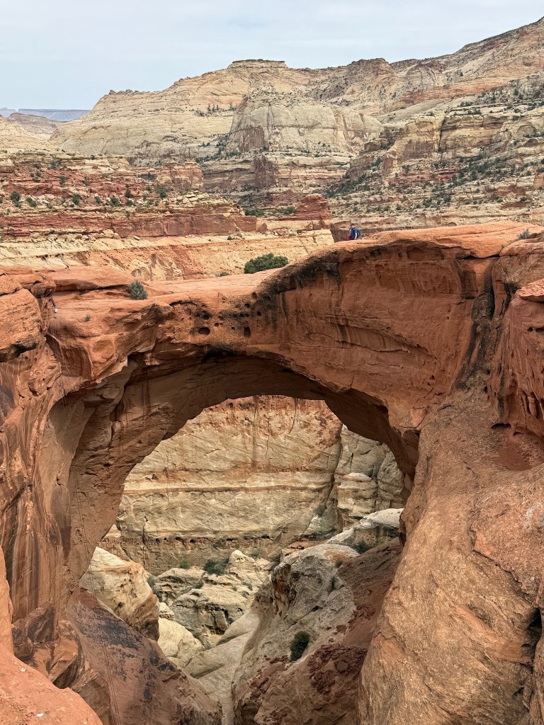
There was a group who were repelling down which was quite a site to experience.
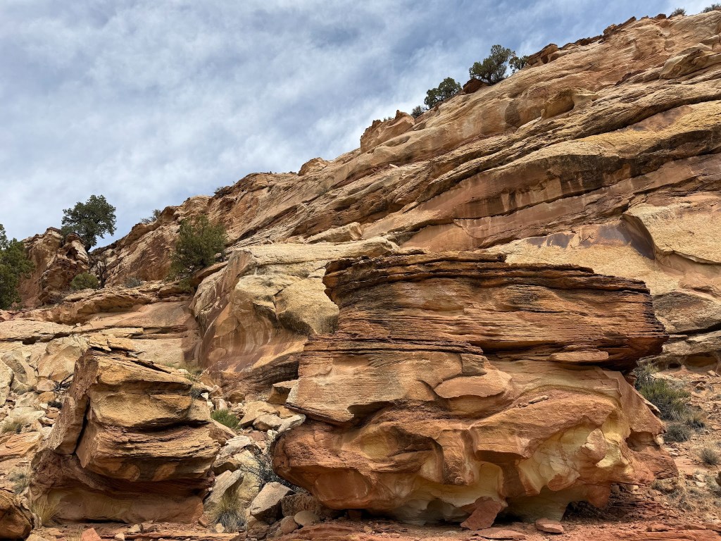
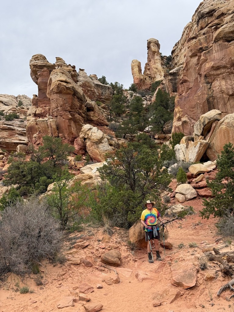
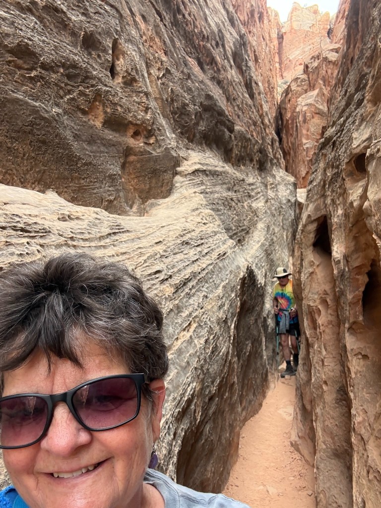
Cohab Canyon Trail
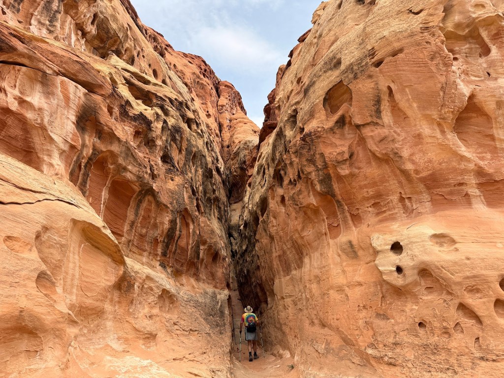
This trail has so many interesting and varied rock formations, from sandy washes to sandstone rock boulders. Erosion is all around in so many forms and then there are the slabs of rock that just crashed from the vertical walls to the canyon and maintain their flat features.
Again the green of cypress and other pine trees and bushes and artistically dead wood make it a creation from the palette of God. About 2 miles along, you meet the Hickman Bridge Parking lot.
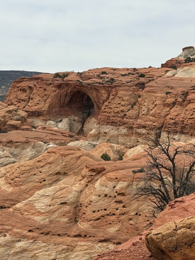
Hickman Bridge
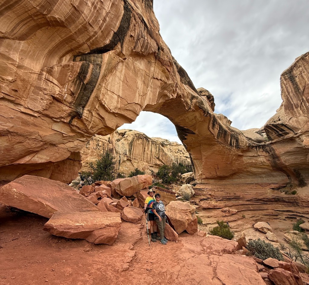
Not sure why this is a Hickman is Bridge and Cassidy is an Arch. But another mile in to see this magnificent structure was so worth the effort.
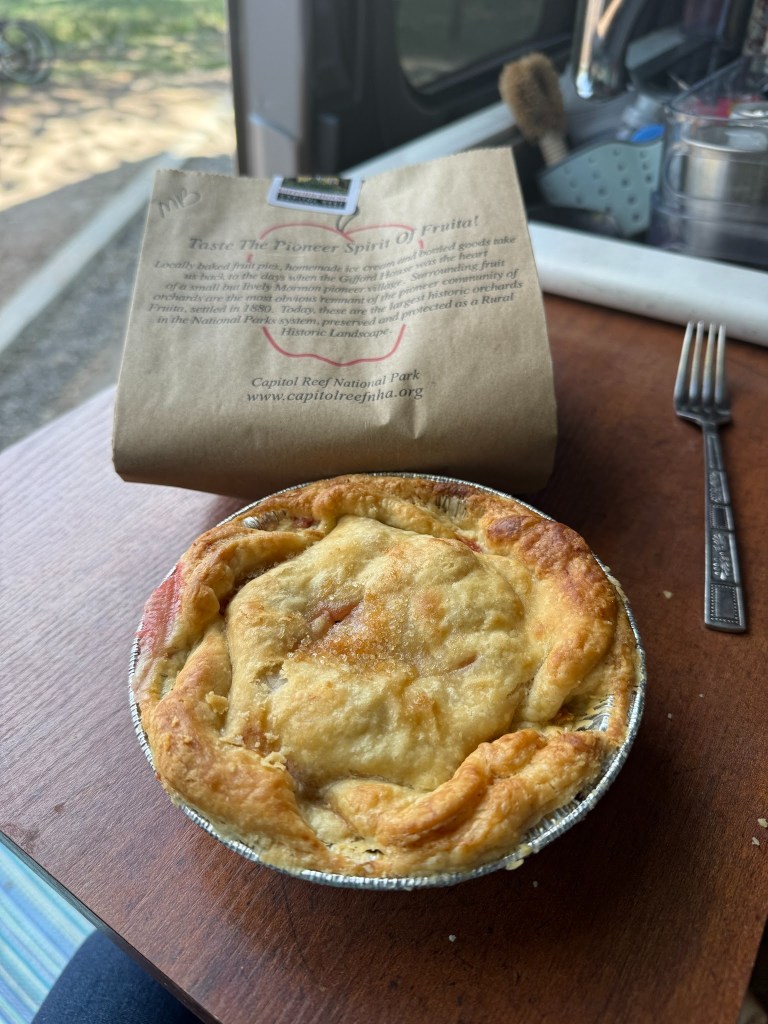
Fruita Campground
Pies are the other incredible feature of the Fruita Campground and Capitol Reef National Park and the green of these trees can be seen from many trails.
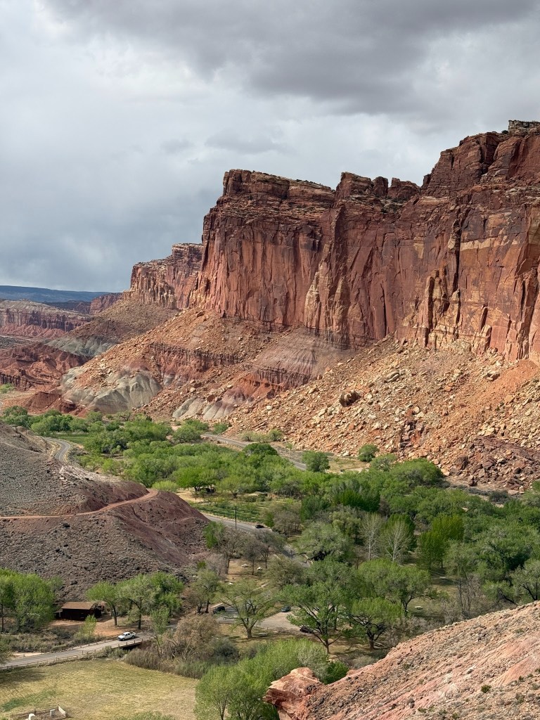
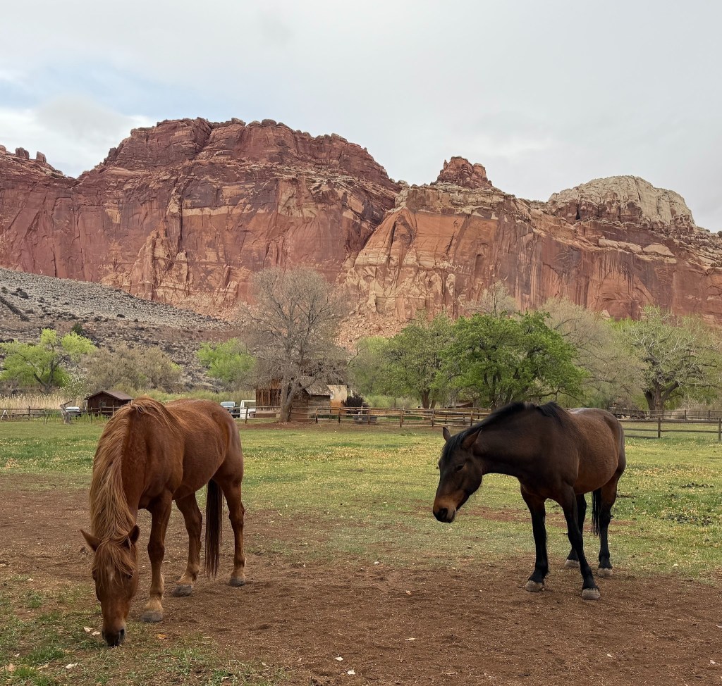
Capitol Reef has a long waterfold that allows water to be trapped for irrigation. The first Mormon settlers planted fruit trees which are still around the campground – evidently if you come in a harvesting season they allow you to pick fruit. A delightful barn with horses where one can pick up the Wi-Fi along the fence is the only connection to the outside.
As a fundraising venture to keep the orchards healthy, there is a well established shop where 100’s of fruit pies are sold each day until they typically run out which is what happened to me in 2022. There are also home canned vegetables and sewn and knitted good in the shop as well.
Only negative were these annoying sticky seed pods that stuck to the bottom of your shoes when stepped on – they were everywhere. We left Capitol Reef early because high winds and cold were forecasted for the day, and decided to drive since hiking was out of the question. Stayed a Green River KOA which had great facilities and got some laundry done – the best part was it was walking distance to an excellent restaurant Tamarisk.
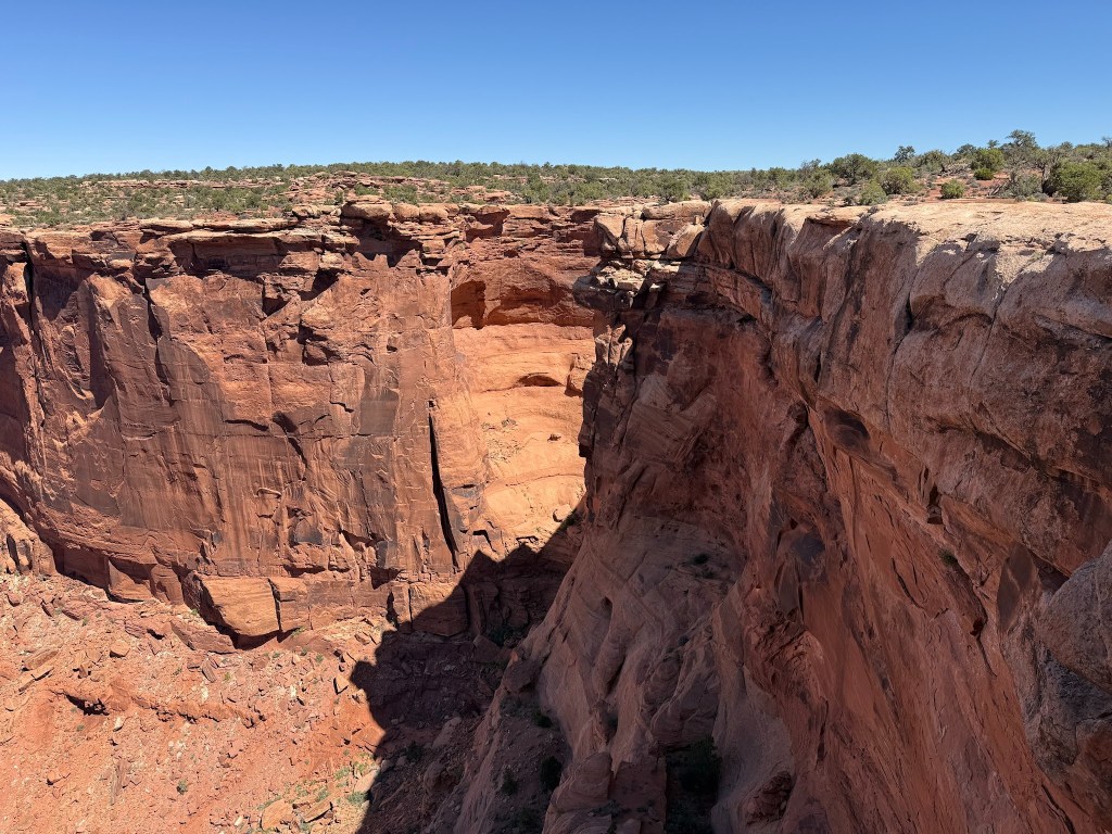
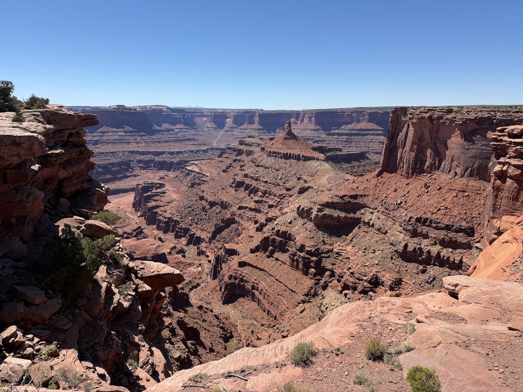
Canyonlands – Island in the Sky District
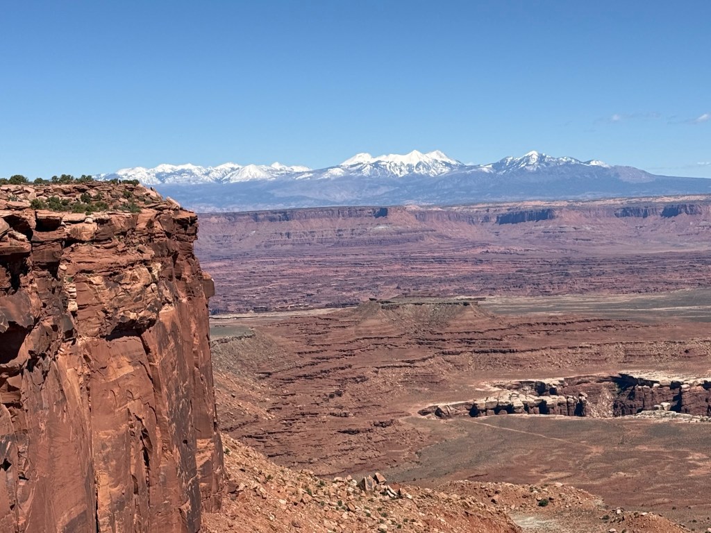
Island in the Sky – it is because much of it is a peninsula that somehow was not eroded away like the canyons all around that lay hundreds of feet below. We drove to the Grand View Point Overlook at the end of the “Island” and did the small hike to the end. A few dirt roads wind below the top on a level further down along the more canyons below.
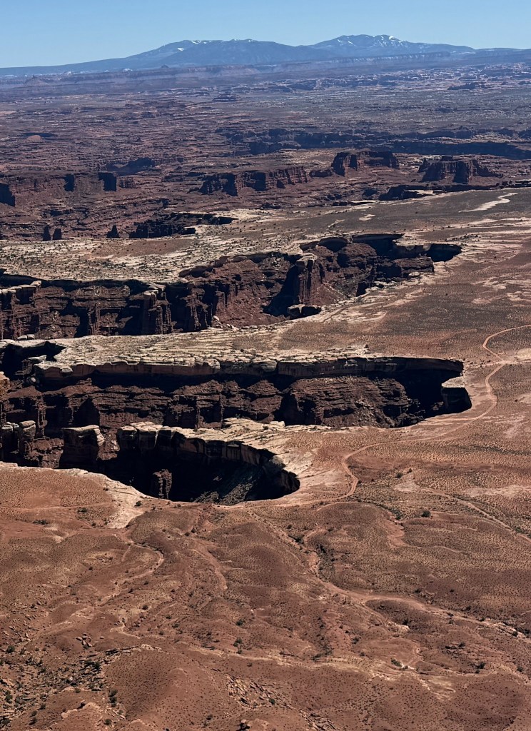
The massive view of the canyons are awesome and there are so many minor peninsulas that stick out along from the Island above. There were no reservable campgrounds, and the hikes are more like short overlooks to the expansive canyon or to the carved more narrow canyons. Mesa Arch should have been a stop, and did not realize it would require a 35 mile back track from where we camped. It seemed like there was a lot of mountain bike activity – which probably was not too hard since the island was predominantly flat.
Dead Horse Point State Park
All of the Utah National Parks have no electricity and since we were out for more than a week, I thought it good to get a full charge. Temperatures were also dipping into the 30s at night so our little space heater was running in the mornings. It was colder than usual for this time of year, but it made hiking in the heat of the afternoon perfect. Great facilities, no showers, but they had hot water and each picnic table was shaded and sites were a paved flat surface.
The great thing about this park is a 4 mile loop hike which went out to the Dead Horse Point and back at the Campground. There is a place on the peninsula that is only about 30 feet wide (now road) where cowboys used to round up wild horses to trap. Nobody really knows what party was responsible, just that lots of dead horses were found trapped by a fence and the steep canyons below. Evidently there are no wild horses any longer, but there are roaming cattle in the area and many signs saying that cows can wander onto the road.
Our 4 mile hike ended up being about 7 miles since we took some of the outlook off shoots from the main trail. Just perfect weather for a long, easy hike. The massive view of the canyon with the Colorado River winding through is incredible.
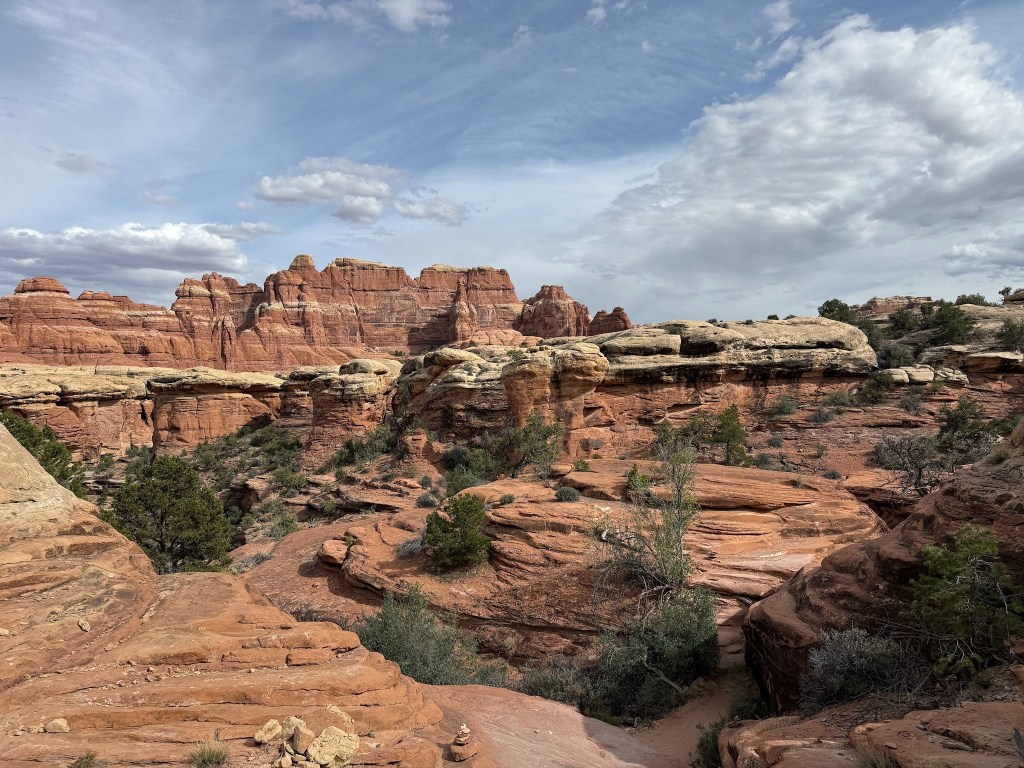
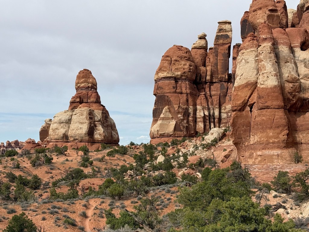
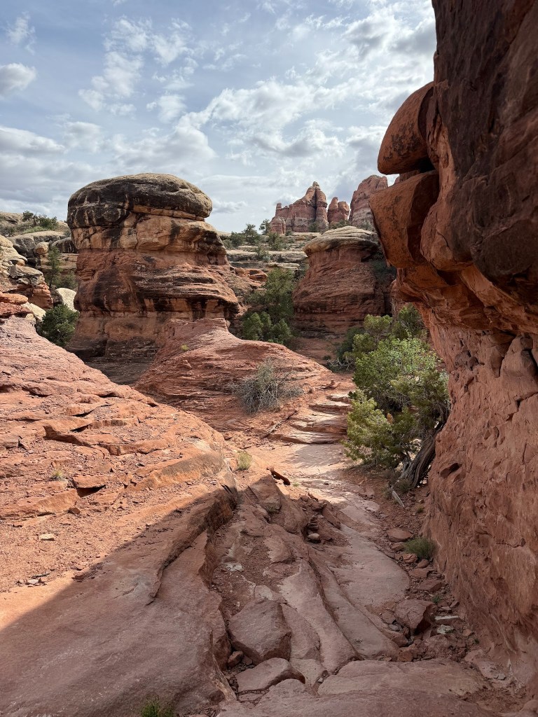
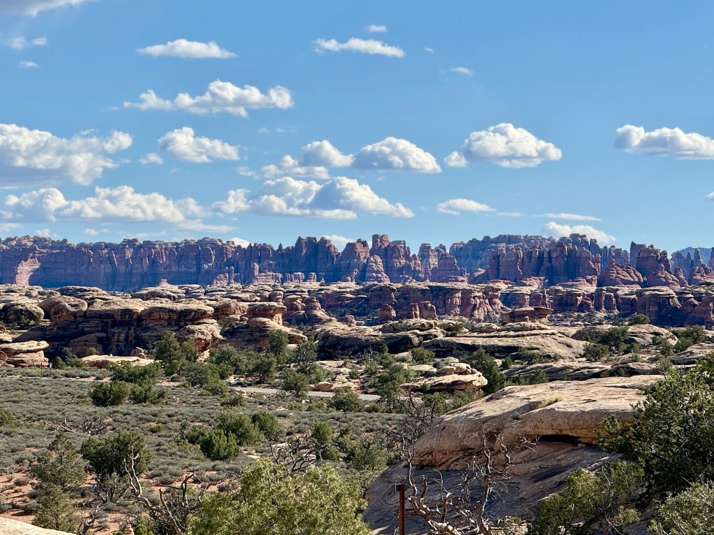
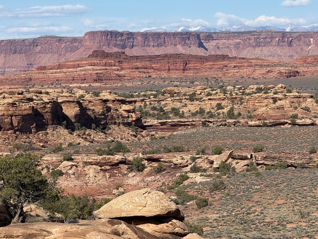
Canyonlands – Needles District
Chester Park Loop
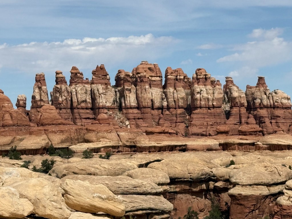
For as short as the hikes were in the Island of the Sky, the Needles District had long ones. The Chesler Park Loop was identified by many bloggers as the most scenic in the park. The only issue was that it was a 11.6 mile strenuous hike which is a push for our limits.
But we were on the trail by 10 am which is unusual given John’s propensity to sleep. The payoff was incredible as we hiked through the sewing basket seeing round top pins, thimbles, and needles. The trail was well marked with cairns because there was a lot of walking over rock as well as climbing between narrow passages of rock and even through a rock tunnel.
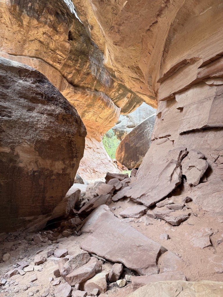
Then expansive fields of the mushrooms, hoodoos and the thin needles made it a trail with so much variety.
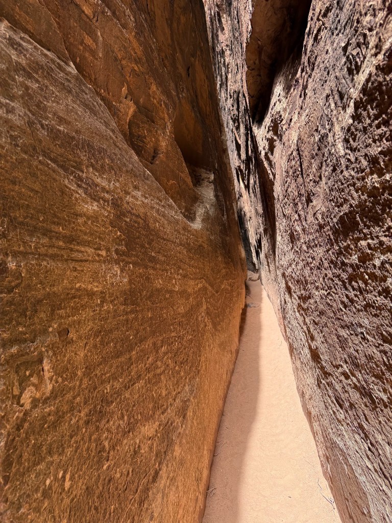
Many of the needles were single monoliths so close to the next except only a crack between. One sandy flat trail took us through a crack for more than 100 yards that at times were less than 2 feet wide, but absolutely straight up vertical rock walls that seemed over 100 feet high until you saw the daylight.
At the end of this sandy path was a wedged log where there were three notches carved out for foot holds. As I am pretty short and not known for my upper body strength, I basically had to lean on the surface above and drag my body using rock protrusions, much like getting on a SUP from the ocean. Nothing graceful about the scramble at all, but I made it just fine – luckily the surface that I had to do the front body slide was a nice red sand. Not too much time to rest because we were averaging about 45 minutes per mile and that would put us at 500 minutes which is 8 hours. Luckily, we hit a couple mile section where it was easy walking through sand and we could catch up and do our typical 20 minute mile. We got around 5:30pm pretty well exhausted but no major issues. It felt good to push ourselves quite hard and have that sense of accomplishment to share as a memory forever. We don’t recall doing a hike that long, so not bad for our age. Many younger people would pass us by but we are quite content to take the smaller more secure steps over places that could easily cause demise. We drank all our 6 liters of water, and we even had some overcast times which was helpful. Part of the trail was on a dirt road for those 4 single wheel suspension terrain crawlers, but luckily we experienced no noise or air pollution on our hike. But this mile or so section was easy, but not so scenic. We were glad that we hiked counter clockwise because lowering yourself down to hit the small foot holds on the log that was in the slot slide down might have been a bit to past our need to not fall comfort level.
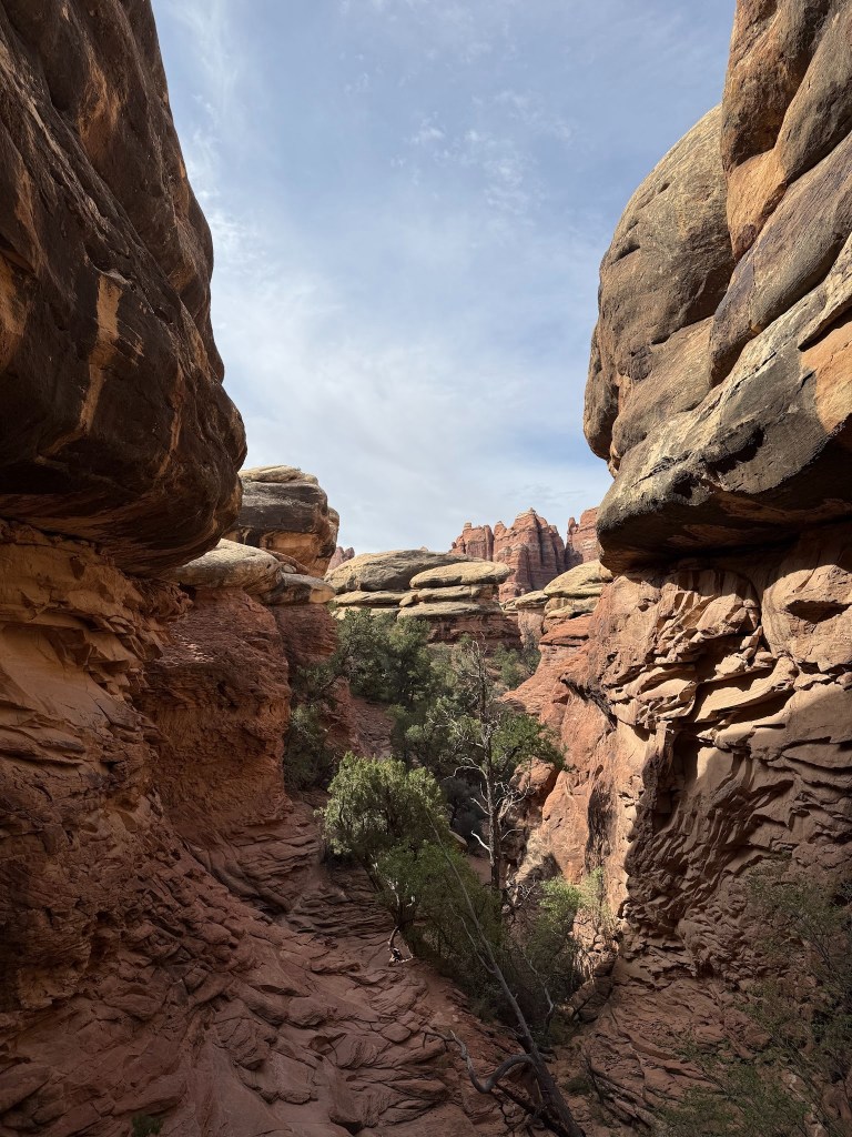
The best part of the hike was the wide variety – seeing the Island in the Sky on the far-off distances to hiking in the pin cushion, to traversing narrow slits and even a cave in the rocks. The hike was a lollipop, hiking few miles in before hitting the loop and finally returning on this same trail. The loop had the cool walk of several hundred feet through the narrow slot in the rock, but it also had the rather boring the few miles of dirt 4 X 4 road and a section through a field which wasn’t that exciting. The stem part of the lollipop provided most of the beautiful scenery and diversity in my opinion, so would highly recommend this out and back section section if time/ability doesn’t permit the entire hike.
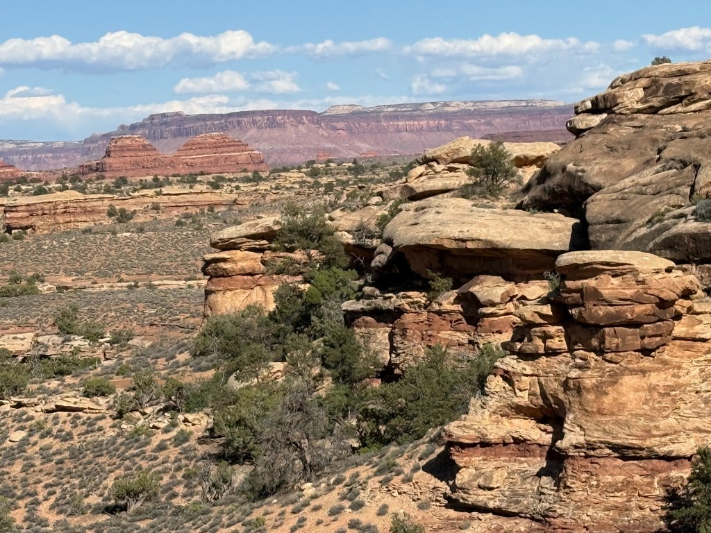
Slickrock Trail
At the end of the Scenic Needles Drive which in itself was beautiful there is the Slickrock trail that runs a bit over two miles depending if you traverse the overlooks. This was a well-marked trail over the rock and providing purples and rust views of the far-off Island in the Sky District of the Canyonland Park.
The park is huge and the only automobile way to get from the two districts is about 150 miles of road. The Slickrock trail also had its share of drop off canyons and lots of up close pushpins, monoliths and rock varieties providing for a delightful late afternoon easy hike.
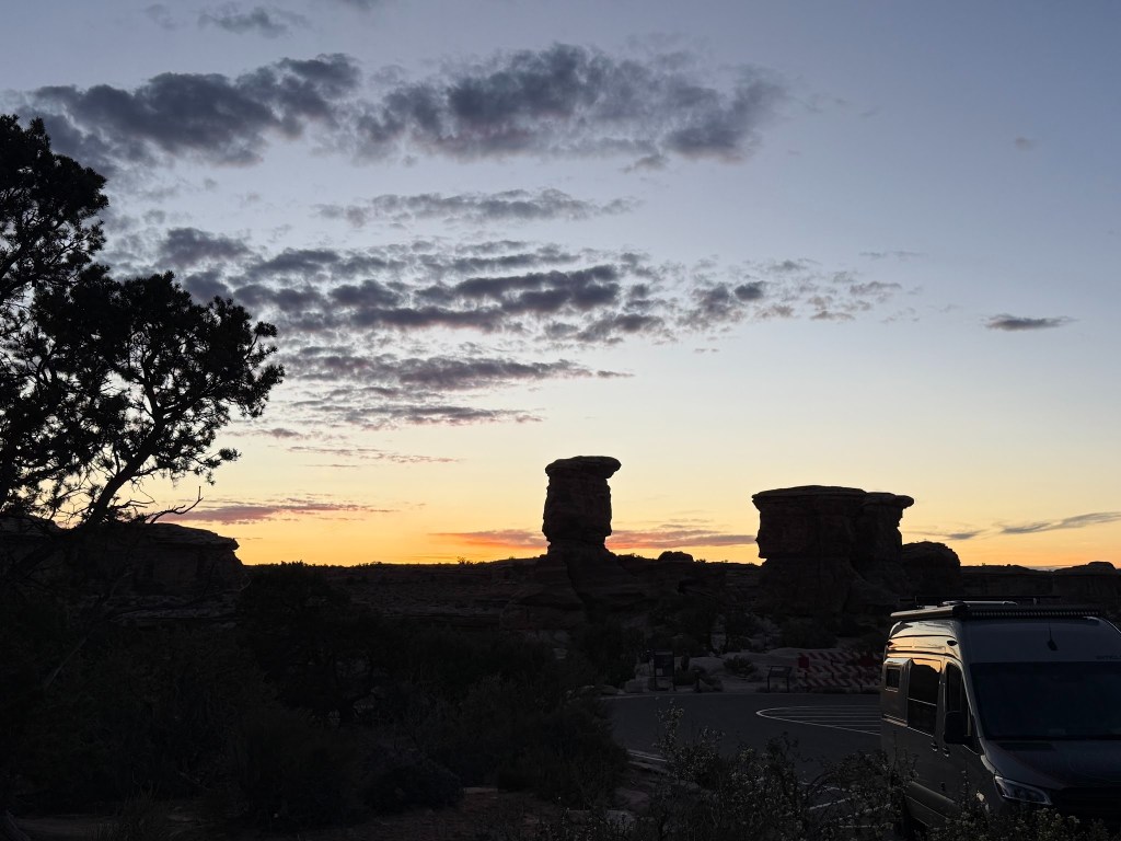
We went to the end of the Scenic Drive and in true Vinny style, I made dinner and we watched the sunset with the whole scene to ourselves.
Cave Spring Trail
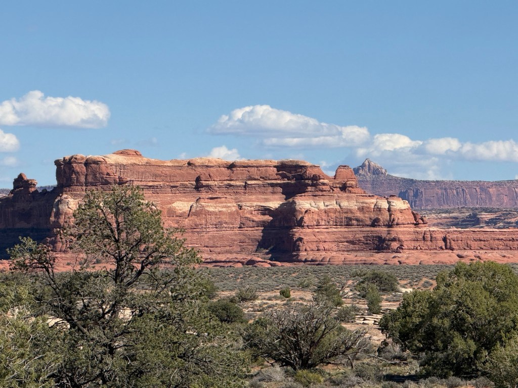
This is a small hike under a huge mushroom monolith where a spring trickled out and there were some non-desert green plants growing on the damp wall. It was a place that provided protection from the elements and even a bit of water for the cattle ranchers or first nation peoples of the land. In the near distance were some of the largest orange-red sandstone monolith castle fortresses in the area.
Canyonlands Summary
As far as which section we liked better, I would say the diversity and hiking in the Needles District was superior, although looking down at the vast canyons from the Island was awestriking. Evidently there is a Rivers District where the Colorado and Green River come together, but generally all these rivers appeared green from above In Moab I just remember the Colorado being milk chocolate and not so inviting, although I could imagine it would look pretty cool looking up the canyons from the water. The Maze District is a 4 X 4 only region where you need to be able to get yourself out of your problems and there looks to be endless possibilities of them.
Camping – I got our site using Camp Scanner a few months prior to our trip as there are relatively few reservable campsites in the Needles District. There are some first come first serve sites so get in with the Host to see who is leaving.. We also stayed at an unoccupied group site with two other families for one night as I didn’t have that night scheduled. B21 was an excellent private site for us and a perfect place to shower off after our grueling Chesler Park Hike. Just outside of the National Park Boundary, was a campground that advertised showers, and that is really something for this area.
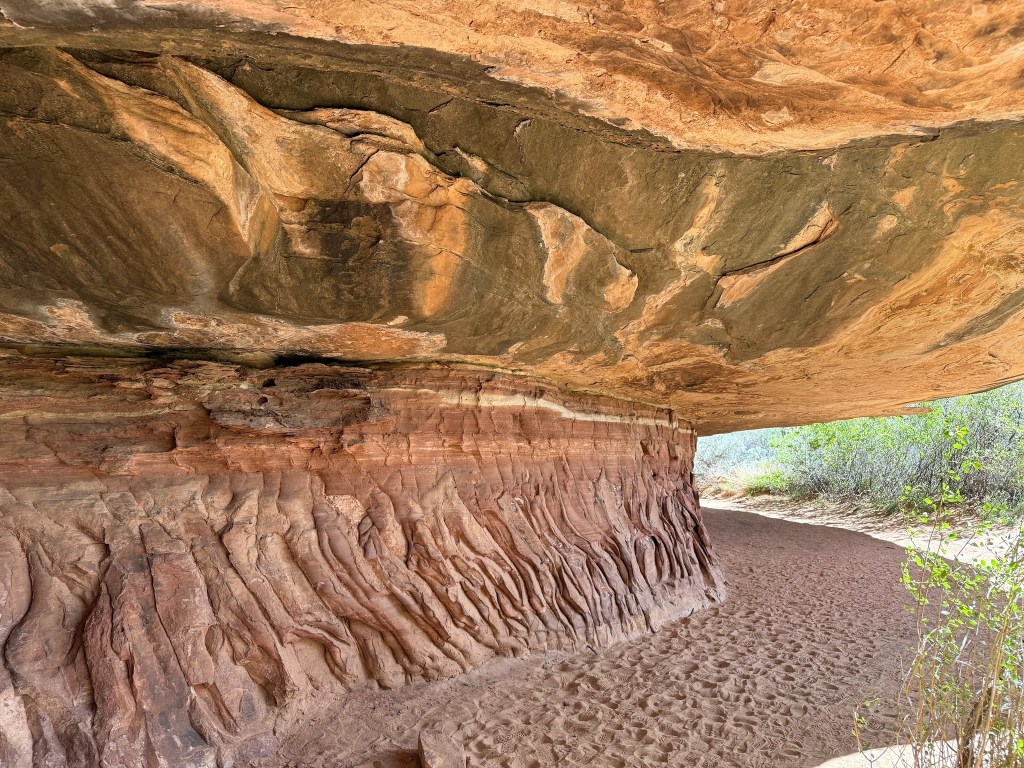
Burning House Hike
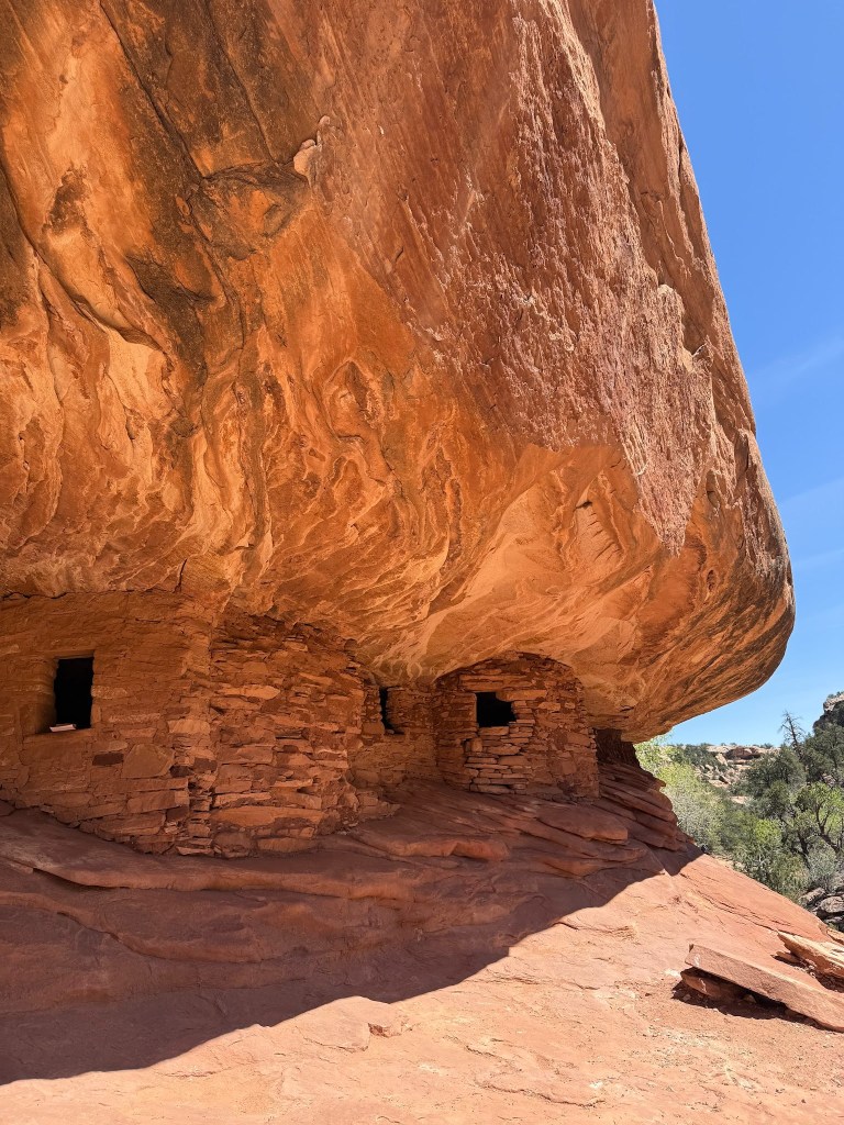
It actually looked like a burning house as we went down the Mule Canyon for about a mile from the Parking Lot. The hike was not particularly nice but the house was hot !
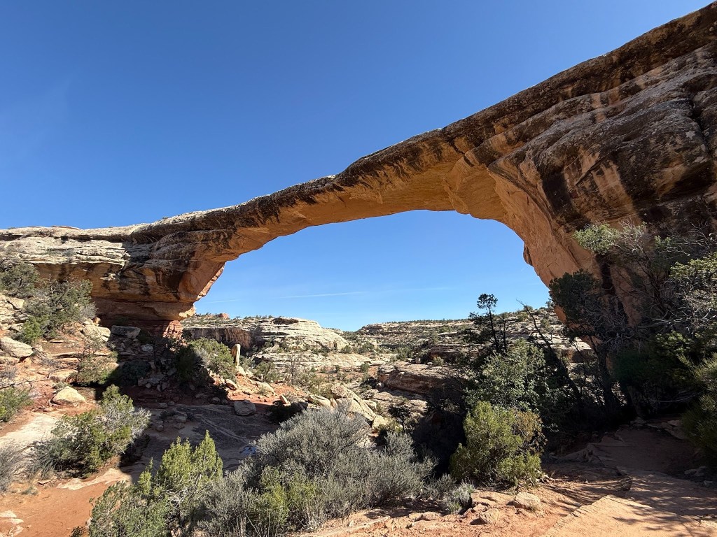
Natural Bridges Monument
The three natural bridges seemed a bit camouflaged from the viewpoints.
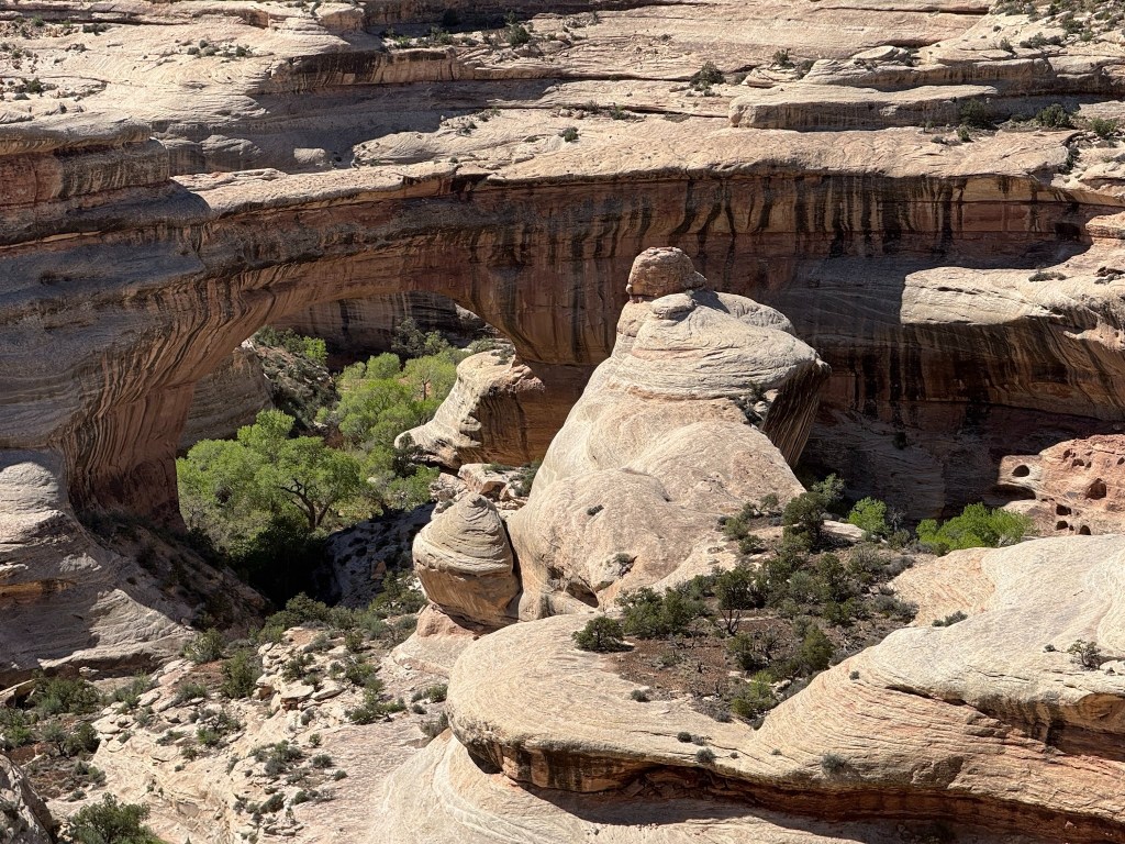
It was a bit warm to hike down all of them because that meant one must hike up too. We were given the tip that the last was the shortest, so when at the so named Natural Bridges Monument, at least one hike was required. It was nowhere as spectacular as Hickman Bridge in Capitol Reef, but it looks like it could fall away the soonest of all the bridges we have seen.
The park was a 10 mile drive through, but the best advice was from the ranger who said we should go down Moki Dugway.
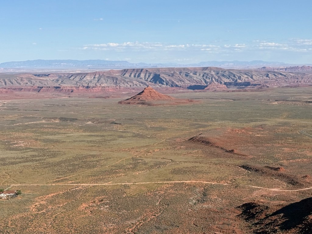
Moki Dugway
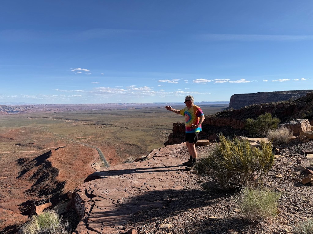
The Moki Dugway not only has a nice ring to its name, but it is very steep narrow gravel road that was used for the abandoned mining of Uranium. The view was incredible over the beginning of the Monument Valley Area. He could have camped at Muley Point which evidently looks over the San Juan River, but didn’t realize we needed to turn before the Moki. One-way on the Moki Dugway was enough for us so after the awe inspiring height and expansive view of the Navajo Nation we decide to go onto Monument
Utah Summary
This area is amazing with Five National Park in the relatively small area compared to California which has nine very diverse Parks. Given how crowded Zion and Arches can be a return to Capitol Reef is in the cards when needing a spring place to explore.
